
After a quick rally from Utah to Vermont in time to catch a few laps on my favorite river, the New Haven, and to catch up with friends on the Deerfield Dryway, Daphnee and I dropped Dog off at my parents’ house and caught a direct flight from NY to Lima, Peru. The only advice we’d been given about Lima was to get out of Lima as quickly as possible, so we went straight from the airport to a bus terminal and took the next (8 hour) bus to Huaraz, a large mountain town nestled at 9000 feet between the Cordillera Blanca and the Cordillera Negra in the Andes.
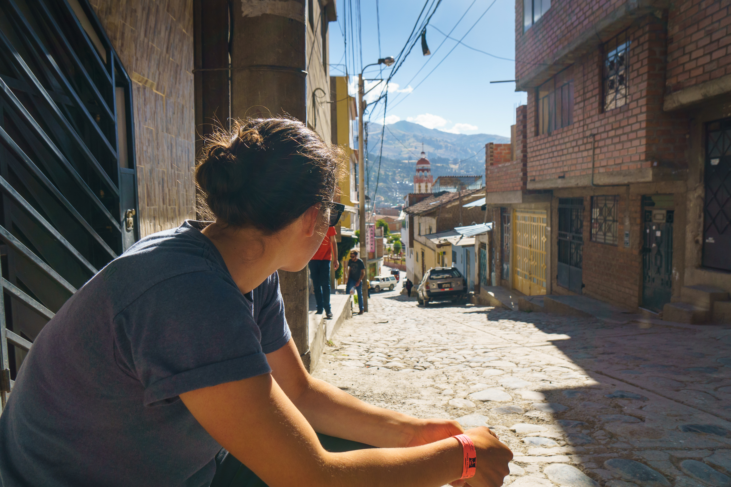
Daphnee Tuzlak hanging out in front of our hostel in Huaraz.
We had a couple days to kill in Huaraz before putting on the Marañon so we decided to see what this whole “tourist” thing is about. Turns out that Huaraz is a major center for trekking, a unique kind of hiking where guides set up and take down camp and burros carry your stuff, freeing you to take selfies for Instagram. As intrigued as we were, our schedule didn’t allow for any of the longer treks so we opted for some more conventional hikes accessible from town without a guide. Some worked out, some didn’t. We learned that it’s always better to ask a bus driver where his bus is going rather than if it’s going to a certain place, because they’ll always just say yes, hurry you on the bus, and take your money. Fortunately, the random dirt road ended up at turned out to be a nice hike with spectacular views of the Cordillera Blanca, even if it wasn’t the hike we were trying to get to.
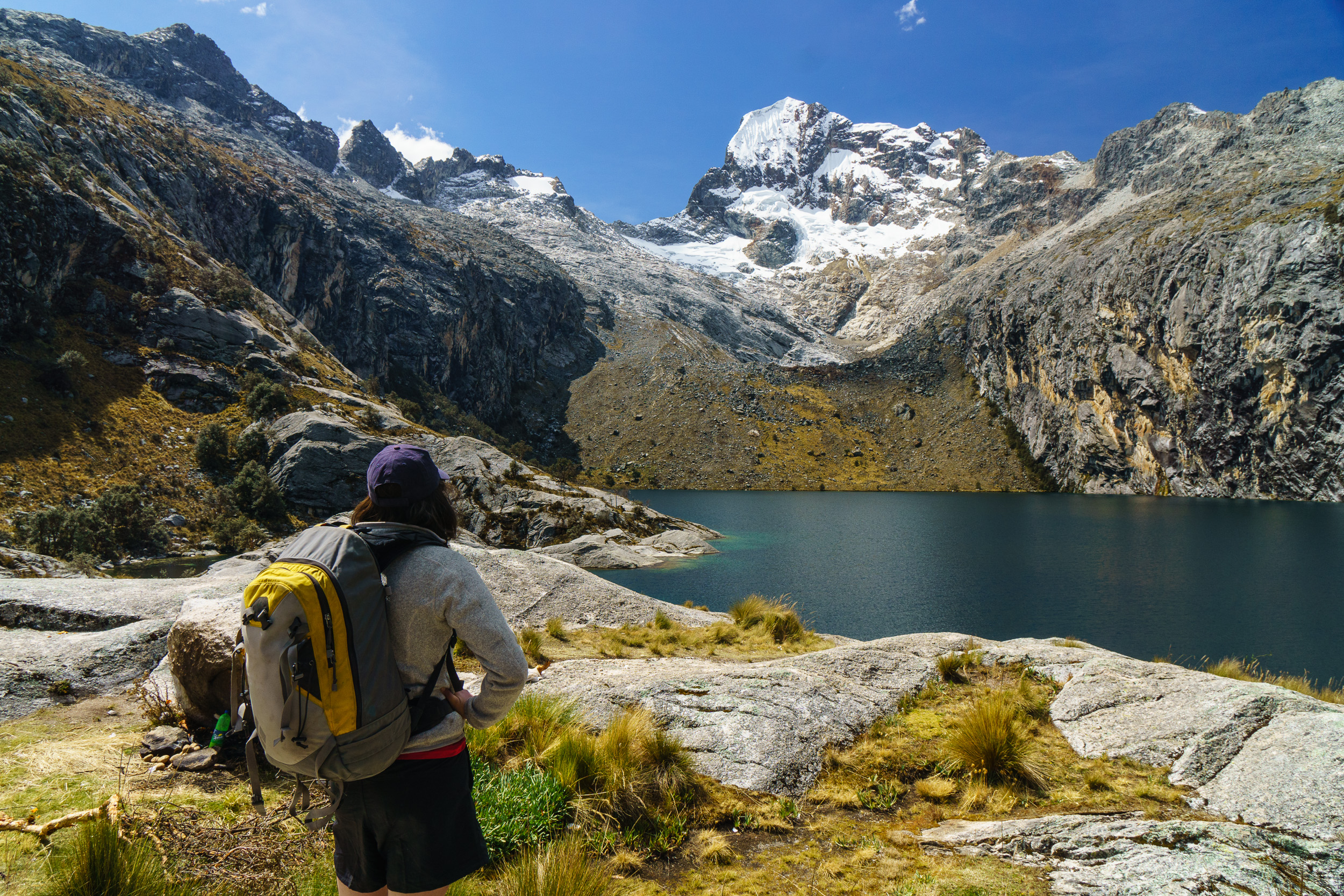
The exact details of this hike are a bit vague…catch a van ride to “Pitec” from a particular street corner in Huaraz. We were told it would only take us partway to the trailhead, but the one we got on took us the whole way. Then it’s a quick couple thousand foot hike up an incredibly steep trail to this high alpine lake, Laguna Churup.
After a few days of suffering around at 14,000 feet — we’re not really hikers — we hit the road for the river. We’d been told you could get a ride from Huaraz to the put-in for $200 US, but we’d also been told that most cab drivers will tell you one price, then stop the car in the middle of nowhere and demand more money, so we opted for the safe route and hired a reputable driver for $300. A casual 9 hours later, we were at “the put-in,” low on daylight and stuck outside a locked gate. Serendipitously enough, the gate functioned the same way most things do in Peru — take out 100 soles and someone magically appears to open it for you.
This map is centered on the put-in. If you don’t have rafts to rig, you can put in upstream at the “highway” bridge or on the Rio Puchka (the tributary on river left).
Not a bad view at the put-in.
The next morning, after only a handful of minor setbacks — like the “raft pump” being a poorly functioning inflatable kayak pump, having to patch the floor of the raft before we left the beach, and a quick panic about how much food we had — we were on the river heading downstream.
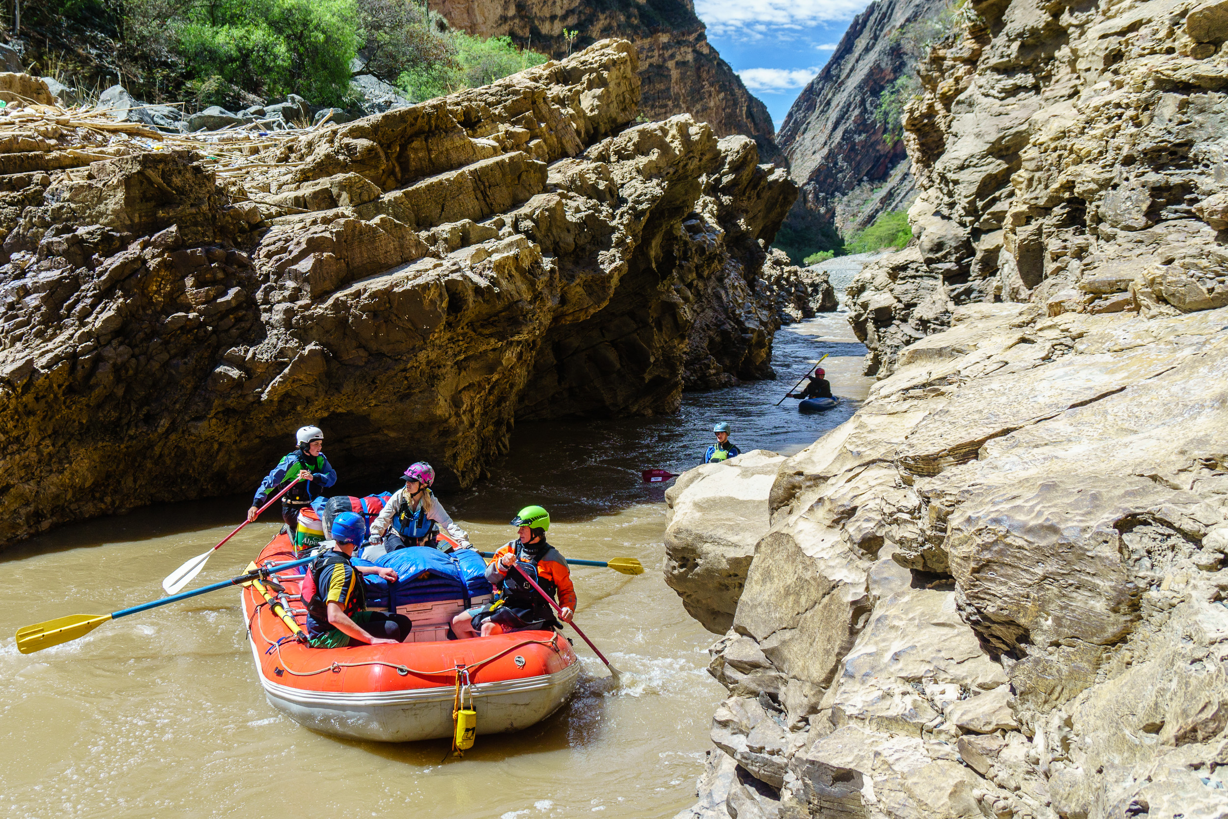
Early on, the river goes through this narrow canyon called Yesojirca Narrows. It’s not more than a foot wider than our raft was and has a squirrely entrance.
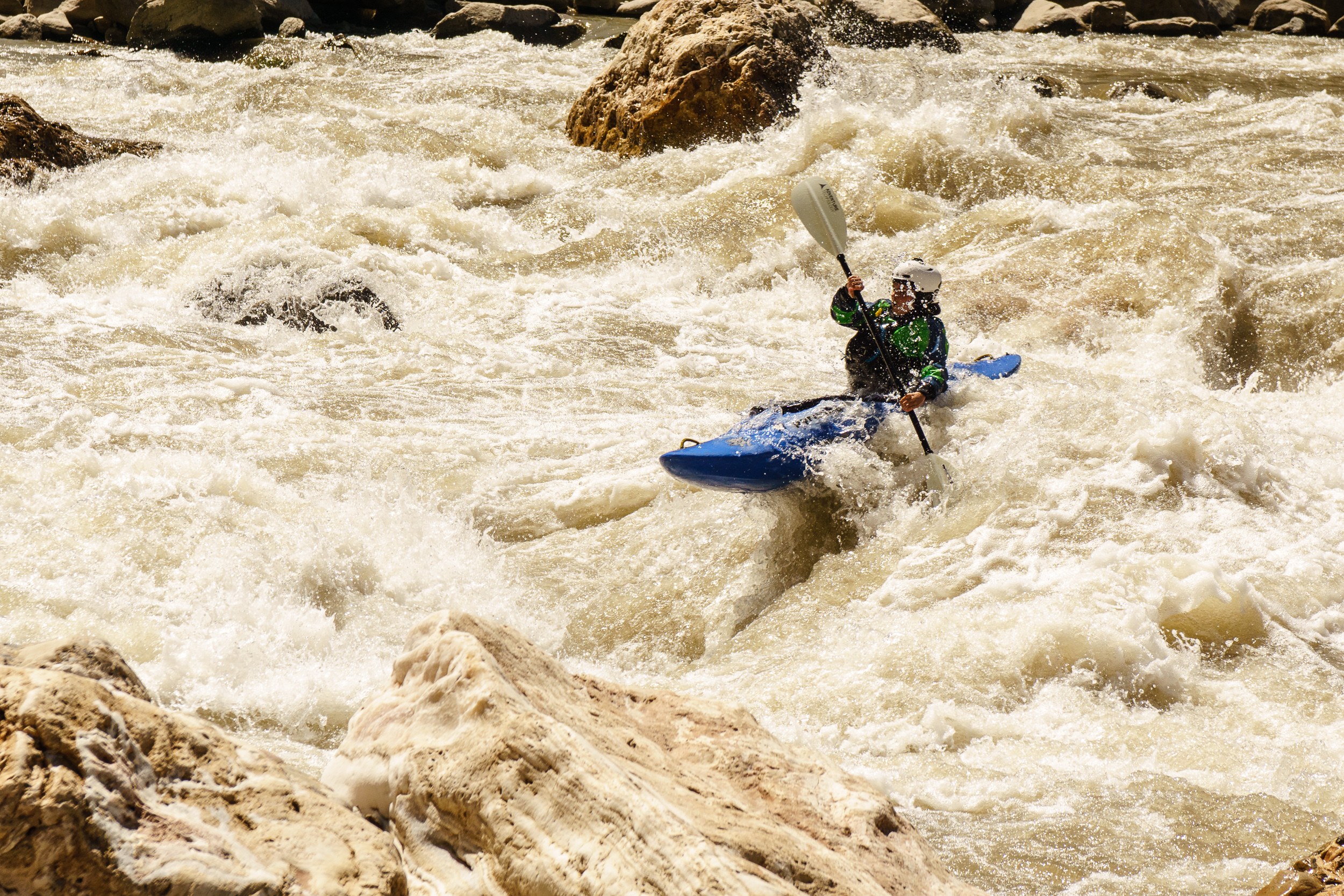
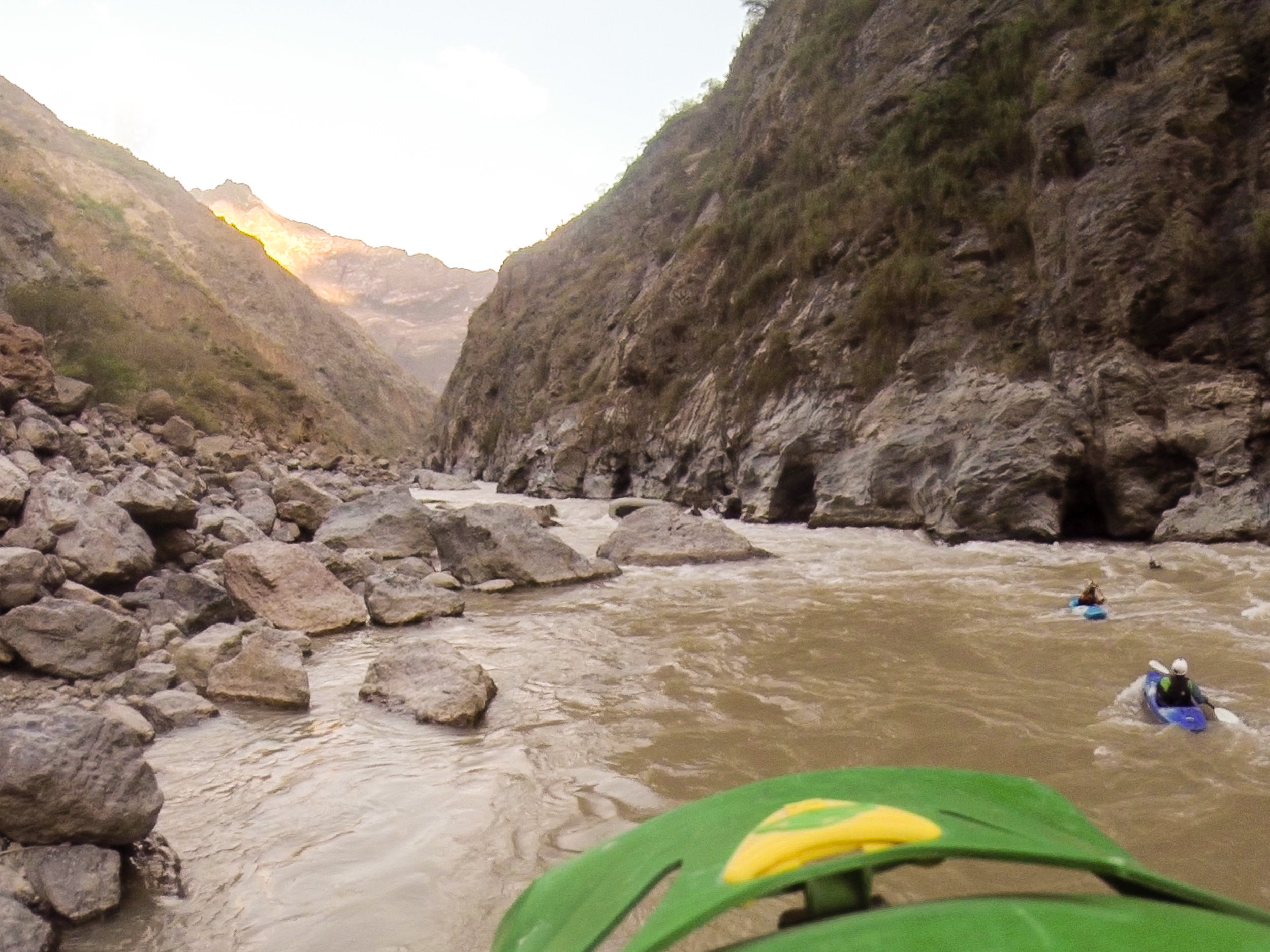
The Marañon is one of the major tributaries of the Amazon. High in the Andean headwaters in mid-July (a low water time of year), we found the volume to be roughly 3000cfs, which made for fun, bouldery class IV rapids with a big-water feel. Similar to Idaho’s South Fork of the Salmon at low-to-medium flows. For the raft in our group, the rapids were technical and challenging. For kayakers, they were straightforward but more than interesting enough to keep us smiling.
Daphnee boofing in the middle of a rapid so fun that I carried my loaded boat back to the top to run it a second time.
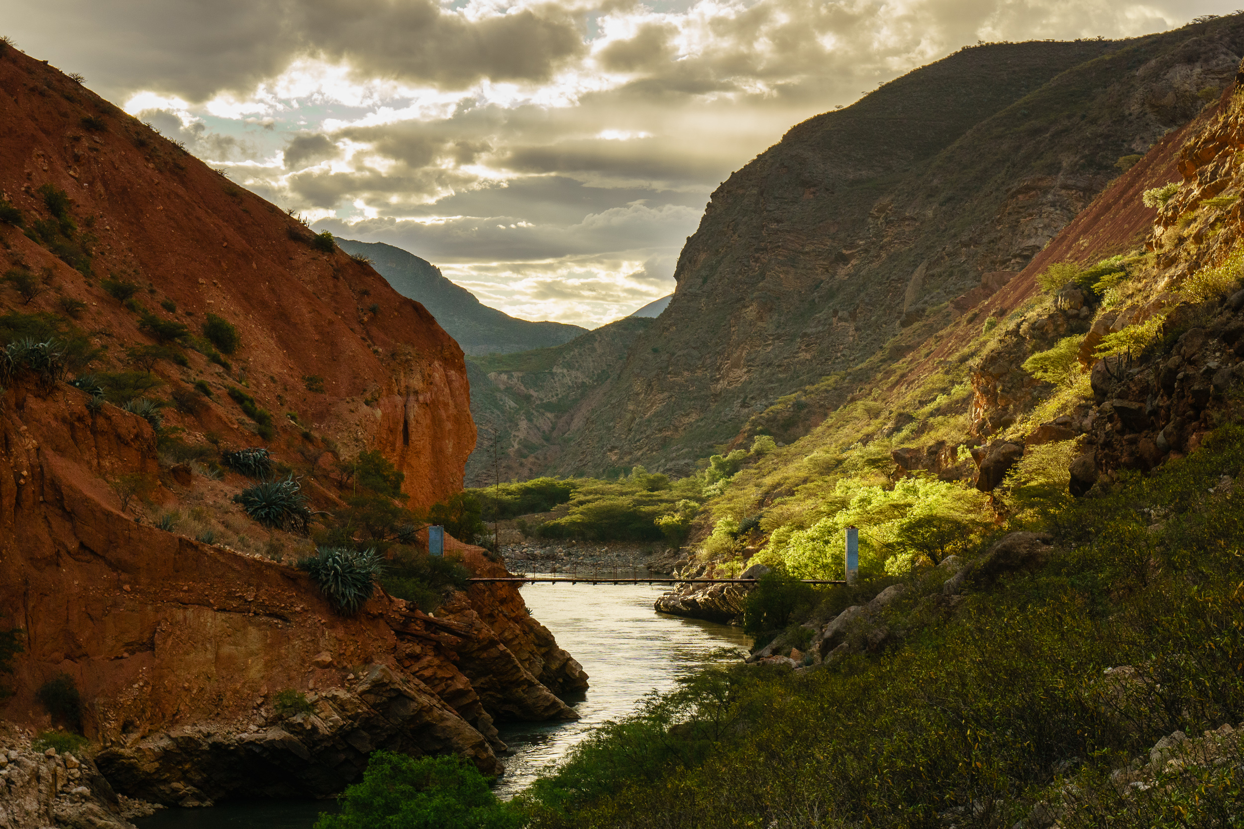
The river’s path north through the Andes passes through every variety of spectacular canyon from menacing sheer bedrock walls to thousands of feet of relief with farms visible far above on the canyon rim. Parts of the canyon are very similar to the Grand Canyon of the Colorado — towering red sandstone walls rising in tiers from the river — but most of it is uniquely Peruvian, somewhere halfway between jungle and desert and difficult to compare to anything we have in North America.
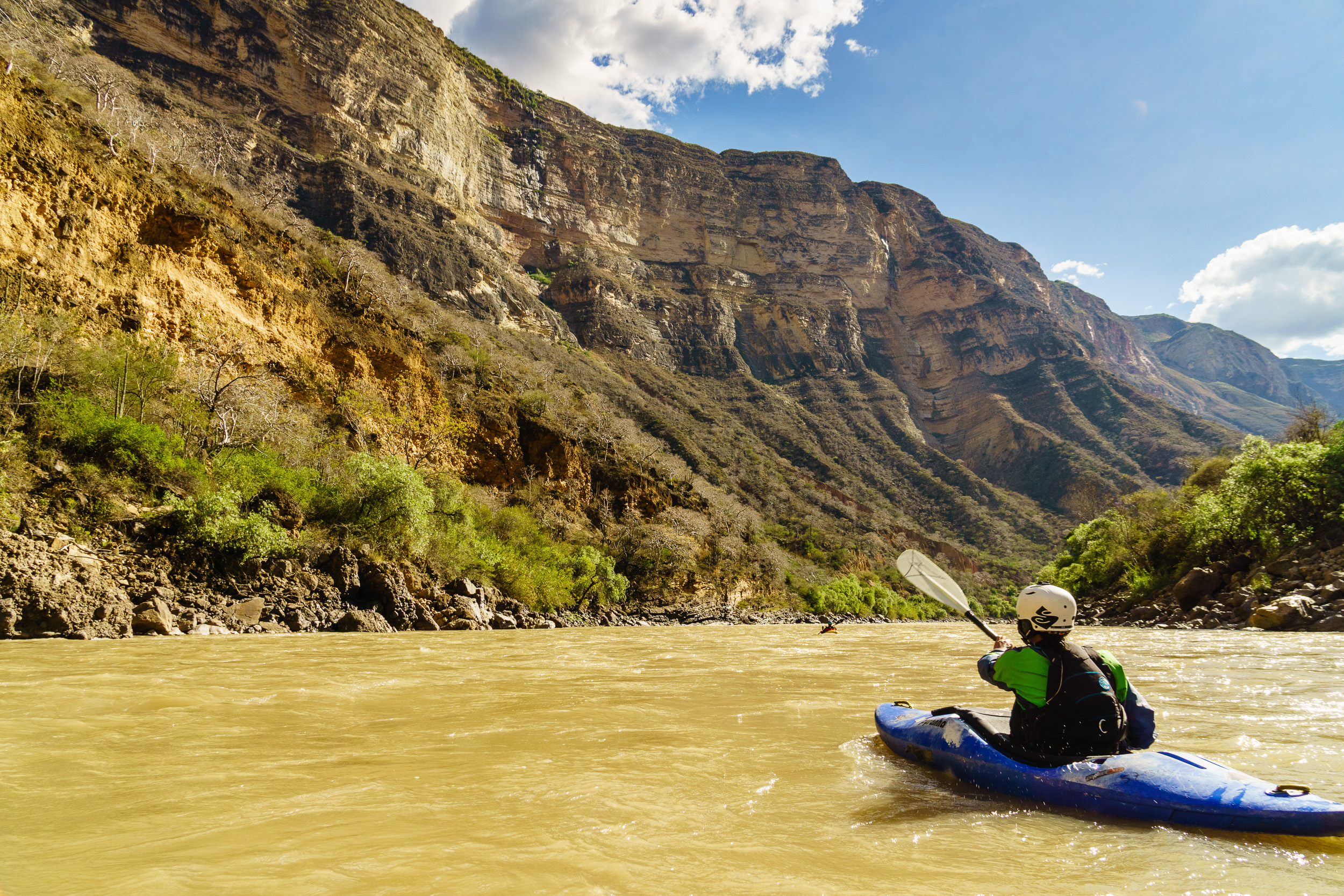
Daphnee paddles under a feature dubbed “Big Wall” by Rocky Contos’s informal guidebook.
Nothing is easy in Peru and the following ten days — as we traveled through the Upper Grand Canyon of the Marañon — were no exception. Some miscommunication in the planning phases led to an unspoken but pervasive food-anxiety; this in turn caused skimpy meals and grumpy paddlers for the first few days. We stopped at a couple homesteads along the way and were given fruits and vegetables that assuaged our fears somewhat, but only somewhat, as our lead negotiator had an odd affinity for papayas that the rest of us lacked. We asked one particularly friendly farmer — whose homestead lay on the banks of the river some three hour’s hike from the nearest town — what he thought about the plans to dam the Marañon, including plans to build a dam just downstream of his home. He was thrilled; the power company had offered to pay him 100 soles per fruit tree ($30 USD) and he figured he could just move his farm up the hill after the dam went in. Plus, he’d have a lake to fish in. I’m not sure he was given all the relevant information…

Entering Shapalmonte, a longer class IV rapid.
A few more days passed and the food anxiety returned, so we decided to stop at a town we believed to be quite close to the river. There were a couple fishermen on the bank who gave us directions to the town — just up the creek-bed, follow the trail. Well, there was a creek-bed, and plenty of trails, but seemingly no town. After an hour or so of wandering around, we came across an elderly couple who gave us more directions. Still nothing.
I swear this town was on the map…
Eventually, we found the town and its one store. The proprietor saw us coming and walked across the street from where he was drying mud bricks, visibly perturbed by this group of lost, wet gringos. We bought rice, a bottle of wine, and a few beers, and all took a sigh of relief before being told we couldn’t take the beers with us. Beer deliveries to the town were few and far between, though, and the bottle deposits in Peru are significant, so the shopkeeper wouldn’t let us leave with the bottles. We enjoyed a few rounds on the stoop in front of the store before beginning to stumble back to the boats with our bounty. En route, we passed through some grassy yucca fields where a Peruvian farmer warned us about snakes. When asked what happens when these snakes bite you, we got two responses: “You go to Lima” or “you die.” We didn’t see any snakes.

Enjoying said wine in some hot springs overlooking the Rio.
The Upper Grand Canyon houses one major river-based challenge — “Wasson’s Landslide.” John Wasson led a group down the upper Marañon in 1977 and described a long, boulder-strewn portage in his notes. I’m not sure John knows this rapid now bears his name — I think Rocky Contos called it that — but it still marks a major challenge for rafts attempting the Upper Grand Canyon. The rapid is kayakable, but it’s long and challenging, and it culminates in a massive sieve that blocks 80% of the river. Whether or not it’s raftable…I’m not sure. I don’t think so, but it’s theoretically possible. For most mortals, this rapid necessitates portaging rafts.
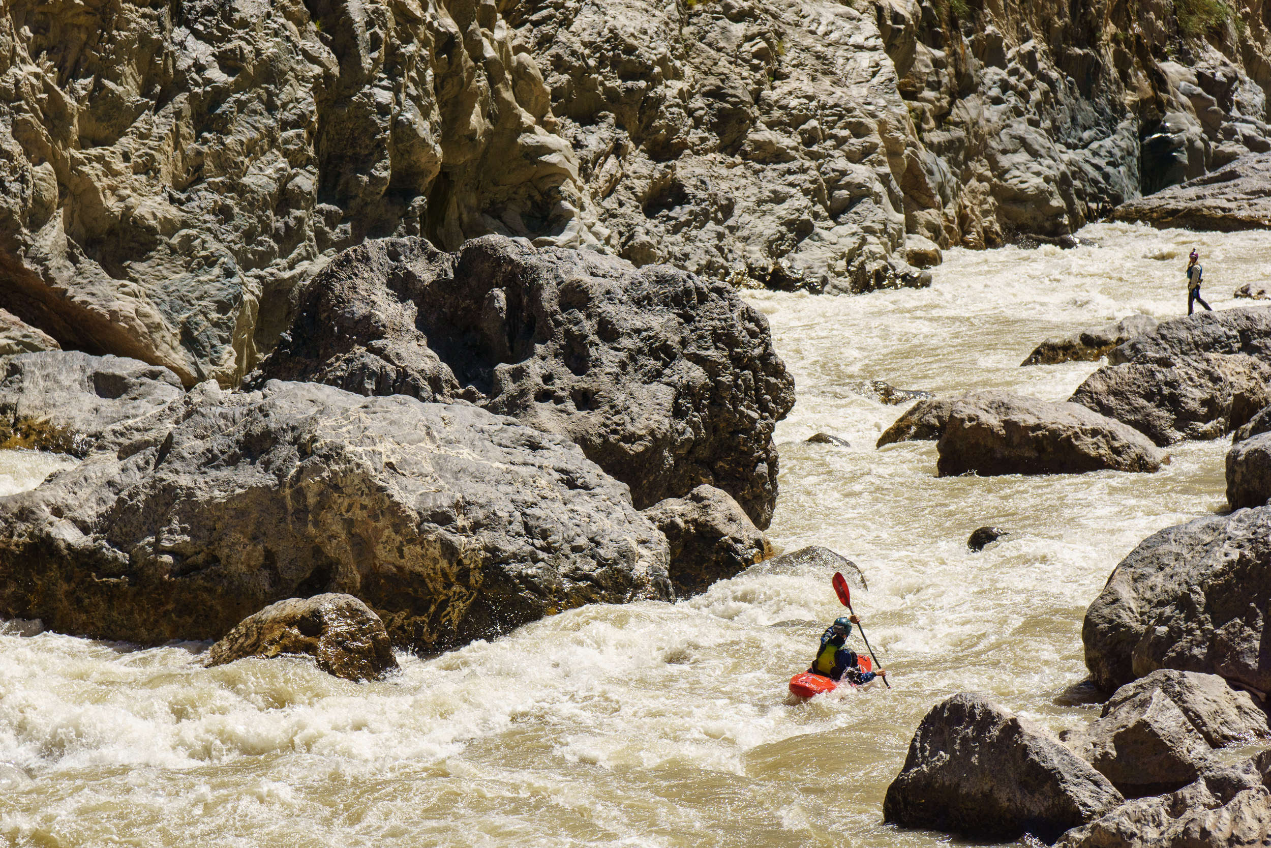
In the midst of Wasson’s Landslide.
We rose early and made it to the entrance of Wasson’s by 9am. I’d never lined a raft down anything before, let alone a long, big volume class IV/V rapid. It’s quite the production. We unloaded the entire raft and carried all the gear to the bottom of the rapid — a one hour scramble over, around, and through massive boulders. Then, we clipped the boat to a rope and “walked” it down the river, one sketchy anchor at a time. Impressively enough, we got through it with minimal hiccups — one cut rope, one terrifying but necessary “bow guiding” episode to get through a particularly technical section, and we were through the worst of it. By the time we got everyone collected near the bottom of the rapid, we were exhausted, there was less than an hour till dark, and we were sitting above a rapid aptly named “Bitch Hole.” It’s more or less what it sounds like: a near-river-wide ledge hole backed up by a wall and a rock. It’s massive. The kayakers in our group ran through a side channel, but the raft chose to run the meat. The outcome was unsurprising in some ways and surprising in others. The raft smashed into the wall, sent its pilot flying, and went for the ride of a lifetime.
Not exactly the sight I was hoping to see.
Miraculously, the raft came out upright and we managed to corral it to shore before both the next rapid and before dark (barely). Less miraculously, the next even remotely possible camp was more than 3km downstream, so we had to route through what turned out to be the best section of whitewater on the trip in dusk…then full darkness.
The survey crew.
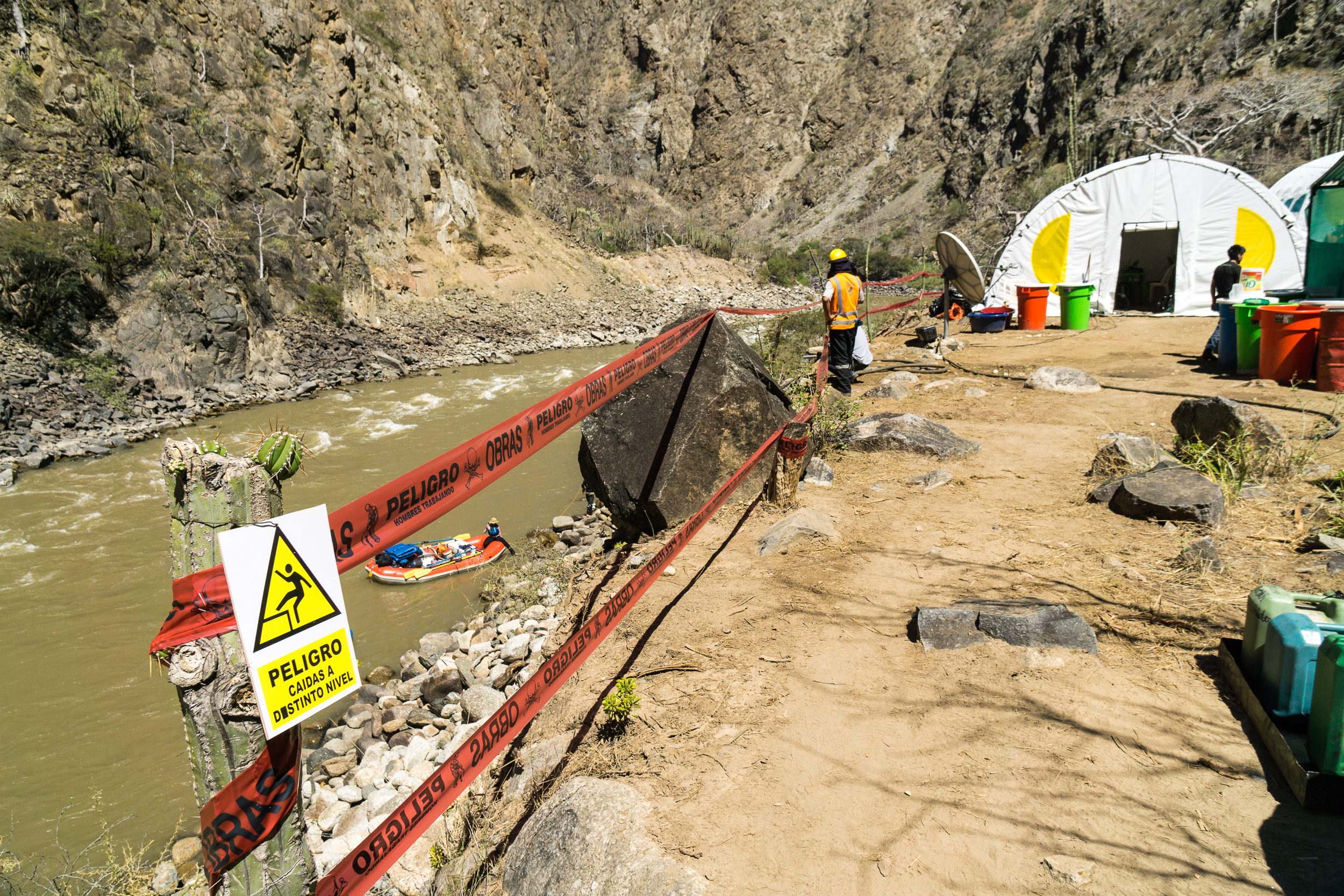
After Wasson’s, the river continues through an amazing, sheer-walled bedrock canyon. In the depths of this canyon, we rounded a bend and came across what appeared to be a large construction site complete with a few zodiacs, a full work-crew, and a handful of chickens. It turned out to be a survey crew from a geologic consulting firm studying the rock to determine whether or not it was a feasible dam site. Interestingly, this spot — which did seem like a good place for a dam from a technical standpoint — was not one of the 20 sites the Peruvian government had already announced they were hoping to dam. When asked, these workers didn’t know or care that two dams were planned shortly upstream and shortly downstream. We asked who had contracted them and where the power would go and they said, “cities in Chile.”
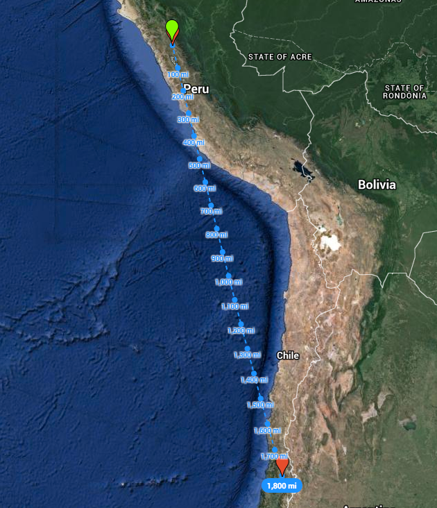
Chile is pretty far.
Shortly downstream, we reached the road bridge at the town of Chagual that marks the end of the Upper Marañon and the beginning of the Lower — a demarcation that exists only in the world of rafters and whitewater paddlers. We derigged, left the gear at Rocky Contos’s storage shed at “Hostal Amigo Kevin,” and began the long journey back to Trujillo for a week of prep before our next trip down the Lower Grand Canyon.
We asked the lady running Hostal Amigo Kevin who Kevin was. It turned out there is no Kevin.

Leaving camp on the last night of the trip.